
Gulf Coast on High Alert: Historic Hurricane Development Threatens Region Ahead of Major Weekend Events
By Editorial Staff
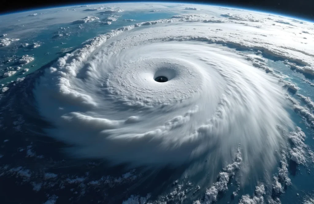
The central Gulf Coast is bracing for a significant meteorological event as a strengthening tropical depression in the Atlantic tracks toward the U.S. coastline. With forecasts indicating a rapid intensification into a hurricane by the end of the week, emergency management agencies from southeastern Louisiana to the Florida Panhandle are mobilizing resources, issuing warnings, and preparing for the arrival of what is poised to be a historically late-season storm.
The Meteorological Outlook: A Rare Late-Season Threat
According to the latest advisory from the National Hurricane Center (NHC), Tropical Depression 9 is currently moving across the Atlantic with a trajectory that places it on a collision course with the Gulf Coast. Meteorologists expect the system to attain tropical storm status by Wednesday, with further strengthening into a hurricane by Thursday. Landfall is currently projected for Friday night, bringing with it a dangerous combination of high winds, storm surge, and torrential rainfall.
This storm, slated to be named Isaias, holds historical significance regardless of its eventual impact. Should it achieve hurricane status, it will become the first named Atlantic hurricane of the 2026 season. More notably, it marks a record-breaking delay in the arrival of the first hurricane of the season. Since the satellite era began in 1966, no Atlantic hurricane has formed later in the calendar year. Previous record-holders included Humberto (2013) and Gustav (2002), both of which reached hurricane strength on September 11. The 2026 season’s late start has been a point of study for climate scientists, who note that while the season began slowly, the environmental conditions in the Gulf are currently ripe for rapid intensification.
Chronology of the Storm’s Evolution
The path of Tropical Depression 9 has been monitored closely since its inception as a disorganized disturbance off the coast of Africa. As it moved westward, it encountered warmer-than-average sea surface temperatures, providing the thermal energy necessary for the system to consolidate its low-level circulation.
- Early Week: The system was officially designated as Tropical Depression 9. NHC models indicated a clear path toward the central Gulf of Mexico.
- Wednesday Projection: The storm is expected to undergo "convective organization," transitioning into Tropical Storm Isaias.
- Thursday Projection: Meteorologists anticipate the storm will reach hurricane strength, utilizing the deep, warm waters of the Gulf as fuel.
- Friday Night: The projected window for landfall. Coastal communities in Louisiana, Mississippi, Alabama, and the Florida Panhandle are under the highest level of surveillance.
Precipitation, Flooding, and Structural Risks
The primary concern for inland communities is the significant volume of rainfall expected to accompany the system. The NHC has projected widespread accumulations of 3 to 6 inches across the affected states. In areas where the storm stalls or tracks slowly, localized totals could reach up to 10 inches.
"The threat of flash and urban flooding cannot be overstated," noted one emergency management official. "Combined with the potential for isolated river flooding, this event could lead to significant property damage and life-safety hazards, particularly in low-lying areas and flood-prone drainage basins."
In addition to water threats, the wind field of a hurricane of this projected intensity can cause extensive damage to power grids, communication infrastructure, and residential roofing. Coastal residents are being urged to secure loose outdoor items, prepare evacuation kits, and review their homeowner’s insurance policies as the landfall window approaches.
Official Responses and State of Emergency
In anticipation of the storm’s arrival, Florida Governor Ron DeSantis has acted decisively, signing an executive order declaring a state of emergency for 25 counties. This administrative action is designed to bypass standard bureaucratic hurdles, allowing for the rapid deployment of the Florida National Guard and the expedited release of state funds for disaster preparation.
"This order ensures communities have the time and resources necessary to prepare for potential severe weather impacts to the Panhandle and Big Bend region of Florida," Governor DeSantis stated in a release via social media. The order provides local municipalities with the autonomy to implement mandatory or voluntary evacuation orders as specific local data warrants.
Similarly, emergency management agencies in Alabama and Mississippi have initiated "Phase 2" of their hurricane response plans. This includes the prepositioning of high-water vehicles, search-and-rescue teams, and utility repair crews who will be ready to mobilize the moment the winds subside post-landfall.
Implications for Tourism, Economy, and Major Public Events
The timing of this hurricane—landing on a weekend—poses a logistical nightmare for local economies that rely heavily on tourism and large-scale public gatherings. The central Gulf Coast is home to several high-profile events scheduled for the coming days, all of which are now in jeopardy.
The National Shrimp Festival
In Gulf Shores, Alabama, organizers are scrambling to evaluate the status of the National Shrimp Festival. The event, which serves as a cornerstone of the regional economy, annually attracts over 300,000 visitors. Scheduled for Thursday through Sunday, the festival relies on temporary structures, outdoor stages, and heavy equipment—all of which are highly vulnerable to hurricane-force winds. A cancellation would result in millions of dollars in lost revenue for local vendors, hoteliers, and the hospitality industry at large.
The Alabama-Georgia Football Showdown
Perhaps the most high-profile casualty of the incoming storm is the colossal college football game between Alabama and Georgia. The matchup, which has already drawn national attention, was slated to host ESPN’s College Gameday—a massive, multi-day production that requires significant structural setup.
Furthermore, the game was expected to feature a high-profile visit from President Donald Trump. The security requirements for a presidential visit, combined with the potential for life-threatening weather, have turned a standard athletic event into a complex emergency management scenario. Officials are currently in discussions regarding the possibility of delaying the game or implementing strict protocols to ensure the safety of the tens of thousands of fans expected to descend on the stadium.
Preparing for the Unknown: A Message to the Public
As the storm tracks closer to the coast, meteorologists and government officials are echoing a singular message: Do not wait until the last minute.
The transition from a depression to a hurricane can occur with surprising speed, especially in the Gulf of Mexico where water depths are shallow and heat content is high. For residents in the path of the storm, the time for "hurricane fatigue"—a phenomenon where long-time residents grow complacent due to a lack of direct hits—must be set aside.
Preparation should include:
- Securing the perimeter: Bringing in lawn furniture, signs, and anything that could become a projectile in high winds.
- Communication planning: Ensuring that family members have a designated meeting point and an out-of-state contact person.
- Stocking supplies: Maintaining a three-day supply of non-perishable food, water (one gallon per person per day), and medical supplies.
- Monitoring official channels: Relying on the National Hurricane Center and local government social media feeds rather than speculative social media rumors.
As the Gulf Coast enters this critical window, the coming days will serve as a test of the region’s resilience and its ability to adapt to an increasingly unpredictable climate. Whether the storm reaches its full projected potential or undergoes a late-stage weakening, the consensus remains that the threat is real, immediate, and requires the full attention of all residents from Louisiana to the Florida Panhandle.
For real-time updates on Tropical Depression 9 and information regarding evacuation routes and shelter locations, please visit your local emergency management agency website or tune into the National Weather Service broadcast.